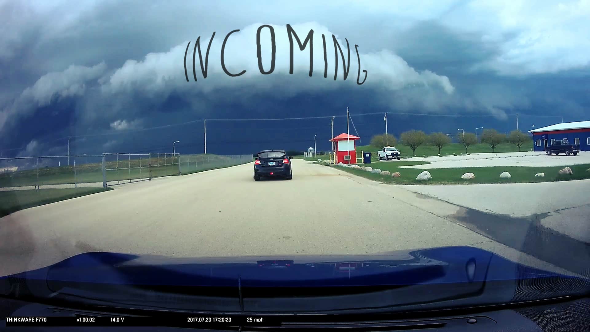
Here’s a fun experience I had coming back from my most recent autocross this weekend. I was following my girlfriend in her STi, and my dad was in the passenger seat, and we ran straight into a very violent storm. Got a little over-excited, as you can tell in the audio. I’m not a storm expert, but I do enjoy watching them, and being in them! Afterwards, I reached out to my storm-chaser friend Jesse Walters, of JR Severe Weather who was able to look over his data, dissect what happened, and explain exactly what we ran into (a “Mesocyclone”). I have provided his analysis beneath the video for those who are interested – it’s quite fascinating, and includes radar and wind-velocity scans of the storm at the time this video was taken.
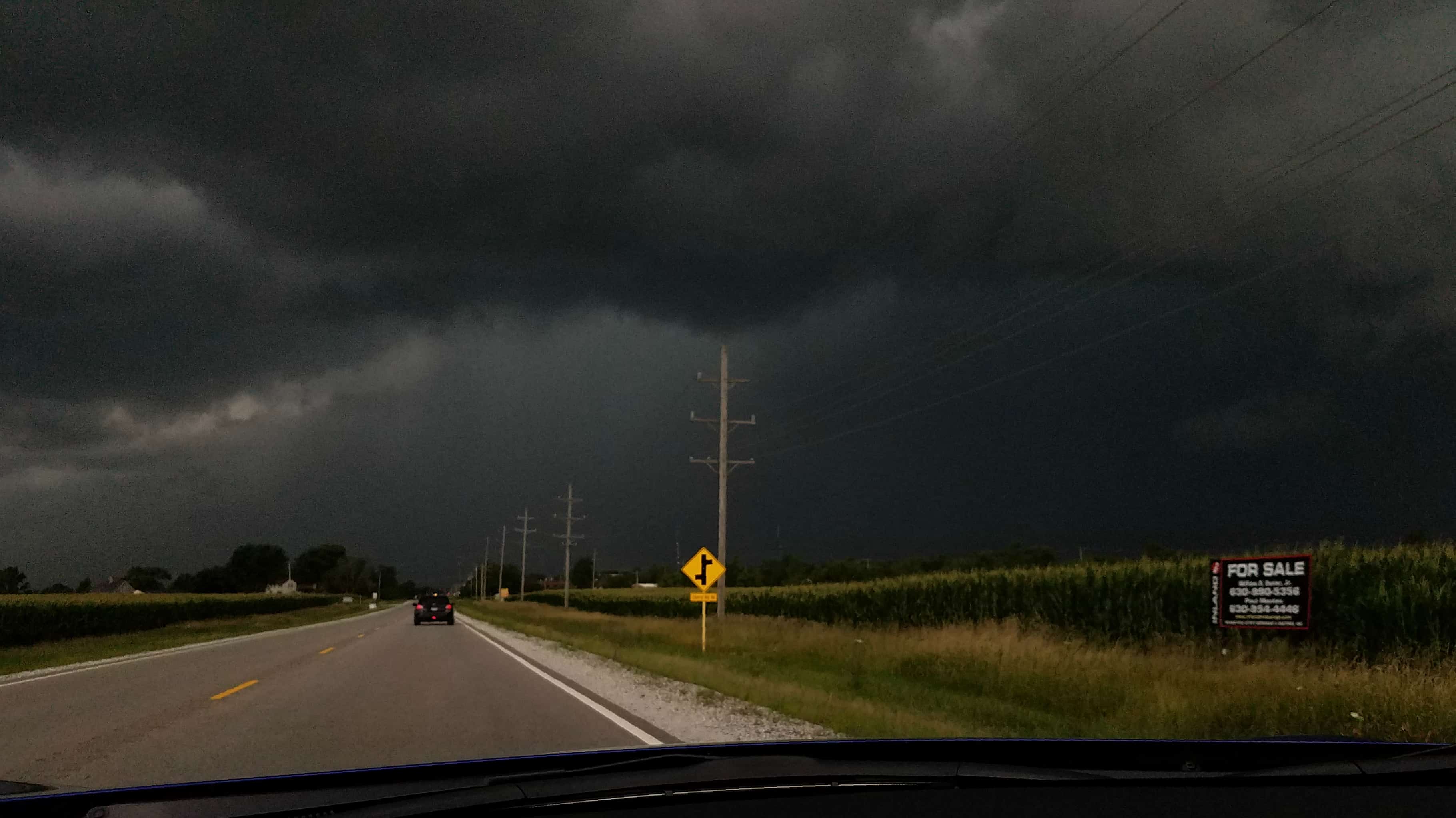
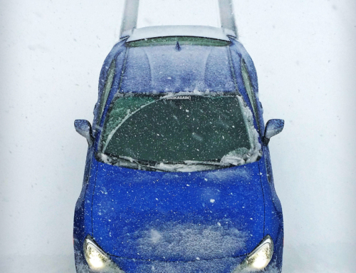
The picture above was taken with my cellphone. I’m including it because although the video shows all the details of what happened, the video is from my dashcam. The dashcam is designed to enhance video brightness in low-light situations for visibility, and so it doesn’t convey how truly dark and spooky the clouds really were. This photo was taken in Pro Mode on my phone, and is a more accurate representation of what we were driving into. You can see that the sky on the right was almost completely black!
The first half of the video below shows the storm front, the wind event, and then both of us freaking out in a gas station parking lot. The second half shows some of the torrential rain and wind we drove through a few minutes later trying to get through the storm.
Jesse Walters (JW Severe Weather)
“RFD is your culprit, not a microburst. They kind of do the same thing, hence why visually on your video I went right to a microburst result.
So, what is RFD? Rear Flank Downdraft is the full name. It is wind associated with a Mesocyclone. A Mesocyclone is the technical term for storm rotation. You were located to the south of the Mesocyclone, generally. That lowering I circled initially was likely the wall cloud feature. However it looks elevated, or higher than usual for a tornadic threat. Tornadoes are not as tall as most folks think. Video kind of makes that illusion. But when I chase these tornadic storm setups, I tend to think I could almost touch the rising scud clouds or even the base of the storm. Yours is clearly up there in height, so thankfully that was averted being in a more populated area.”

“As you can see here, I highlighted a curvature which is typical in a supercell thunderstorm radar signature. Notice KLOT is in the middle of this storm; that’s the Romeoville radar site. Since radar can only look so far upward and so far horizontally, this makes it the worst place for an accurate radar signature. This image was taken from Lincoln, Illinois to compensate, but the curvature of the earth comes into play here. So the radar beam from Lincoln at it’s lowest scan level, is still looking upward into the mid-areas of the storm, not the base levels where the real tornadic action resides.”
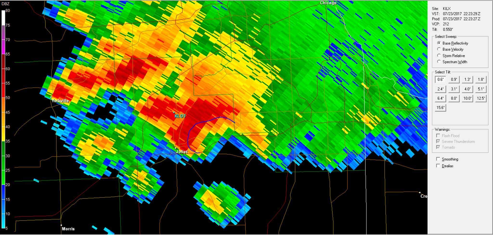
“This image is a radar velocity scan. Green colors are winds headed towards the radar while red is away from the radar. This radar signature that I circled is known as a couplet. This signifies rotation, but again is looking upwards into the storm a bit. Most storms rotate to some degree, so seeing this does not scream tornado; just a healthy, bouncing baby of a supercell. The blue line with the arrow is showing how RFD winds come around the backside of the rotation (Mesocyclone) while the reds are showing inbound warm air particles which are fueling the storm itself.
It’s such a complex process, so I hope I’m making sense with all this info I’m throwing at you. In conclusion, you took on the dry air wrapping around the backside of the rotation area, kicking up dust as it overtook you in that intersection. Now had that been a fully developed tornado, those RFD winds would have been even stronger, dependent on the strength of the Mesocyclone and associated tornado. Hope this helps and really enjoyed looking into this! Again, I’m pissed I wasn’t there…haha!”

The back of my car looks sooo goood
Almost as good as mine!